330 ST PAUL ST 5 & P26
Owner Information
330 SAINT PAUL ST LLC
335 LAKE AVE #1
NEWTON, MA 02461


Property Details
330 ST PAUL ST 5 & P26 is classified as a Residential Condominium (Row end).
The primary structure on this property was built in 1925. There is 1,045ft2 of residential/living space within this property. This property is listed as having 4 rooms.
330 ST PAUL ST 5 & P26 is valued at $737,800. The land is valued at $0 and the structures are valued at $737,800.
330 ST PAUL ST 5 & P26 was last sold on Thursday, July 3, 2014 for $476,580.
Assessment data from fiscal year 2021.
Flood Data
According to the FEMA National Flood Hazard Layer, this property does not appear to be in a flood zone. It may also be in an area not yet reviewed. Nonetheless, confirm this information prior to taking any action.
To view the flood hazards around this property, create a FEMA "Firmette" Map of the area around 330 ST PAUL ST 5 & P26.
Broadband Internet Providers
| Provider | Type | Bandwidth (mbps) | |
|---|---|---|---|
| GCI Communication Corp. | Satellite | 0 | 0 |
| netBlazr Inc | Fixed Wireless | 50 | 50 |
| Comcast | Cable | 1000 | 35 |
| Viasat Inc | Satellite | 100 | 3 |
| Starry, Inc. | Fixed Wireless | 200 | 200 |
| RCN | Cable | 500 | 20 |
| Verizon New England Inc. | DSL | 15 | 1 |
| VSAT Systems, LLC. | Satellite | 2 | 1 |
| HughesNet | Satellite | 25 | 3 |
| RCN | Cable | 1000 | 20 |
Broadband service provider data from December 2020.
Adjacent Properties
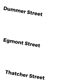
- 73 THATCHER ST
Apartments with Four to Eight Units owned by 73 THATCHER ST LLC - 79 THATCHER ST 2 & P18
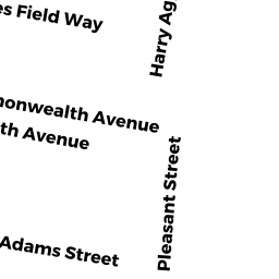
Residential Condominium owned by SILVER MITCHELL D & RACHEL E - 185 PLEASANT ST 3-1 & G16
Residential Condominium owned by KETKAR KANCHAN - 79 THATCHER ST 3 & G15
Residential Condominium owned by LEWIS JAYE E - 185 PLEASANT ST B-1
Residential Condominium owned by RIORDAN TIMOTHY - 185 PLEASANT ST 1-1 & G10
Residential Condominium owned by NEMETZ JAMES & DOROTHY J - 185 PLEASANT ST 1-2 & G12
Residential Condominium owned by KEEFE MAUREEN C - 185 PLEASANT ST 2-1 & G9
Residential Condominium owned by IMBER SHARON - 185 PLEASANT ST 2-2 & G11
Residential Condominium owned by OLIVEIRA JUDITH M - 185 PLEASANT ST 3-2 & P19
Residential Condominium owned by OLIKARA ANOOP G - 193 PLEASANT ST 1-1 & G7
Residential Condominium owned by TAYLOR GERARD - 193 PLEASANT ST 1-2 & G6
Residential Condominium owned by GLICK DAVID M - 193 PLEASANT ST 2-1 & G13
Residential Condominium owned by SERIY TRS VICTORIA - 193 PLEASANT ST 2-2 & G8
Residential Condominium owned by GOLABCHI FATEMEH NOUSHIN & SEYED A - 193 PLEASANT ST 3-1 & G2
Residential Condominium owned by MIRNY LEONID & ANNA - 193 PLEASANT ST 3-2 & G1
Residential Condominium owned by GELB AARON - 199 PLEASANT ST 1-1
Residential Condominium owned by DUROCHER TR BRIAN G - 199 PLEASANT ST 1-2 & G3
Residential Condominium owned by GLANTS ALEX & MUSYA - 199 PLEASANT ST 2-1
Residential Condominium owned by CLUNAN PATRICE M - 199 PLEASANT ST 2-2 & G4
Residential Condominium owned by CIEMPA JEFFREY S & SHANNON R - 199 PLEASANT ST 3-1 & P17
Residential Condominium owned by DEPIS FABIEN - 199 PLEASANT ST 3-2 & G5
Residential Condominium owned by BASTARACHE CLARENCE & DANA - 79 THATCHER ST 1 & G14
Residential Condominium owned by MORRISSEY ROBERT - 55 THATCHER ST 2
Residential Condominium owned by GELLIS LIFE ESTATE HELEN L - 61 THATCHER ST 6
Residential Condominium owned by TESIK PATRICIA - 55 THATCHER ST 1
Residential Condominium owned by DBF PROPERTY MANAGEMENT LLC - 55 THATCHER ST 1A
Residential Condominium owned by KOFMAN GENE - 55 THATCHER ST 3
Residential Condominium owned by ZHENG JUE - 55 THATCHER ST 3A
Residential Condominium owned by KOFMAN GENE - 55 THATCHER ST 4 & P-9
Residential Condominium owned by LIU SONGLAN - 55 THATCHER ST 5 & G10-P3
Residential Condominium owned by SUI LEI - 55 THATCHER ST 5A
Residential Condominium owned by GELLIS LIFE ESTATE HELEN L - 55 THATCHER ST 6 & P6
Residential Condominium owned by WANG XI - 61 THATCHER ST 1
Residential Condominium owned by LEVITAN, TRS LEONID & ANNA - 61 THATCHER ST 1A & G-6
Residential Condominium owned by SCHWARTZ, TRS MARC R & HOWARD - 61 THATCHER ST 2 & P11
Residential Condominium owned by FELIPE MIGUEL N - 61 THATCHER ST 2A
Residential Condominium owned by LIU SONGLAN - 61 THATCHER ST 3 & P5
Residential Condominium owned by ZHANG FENG - 61 THATCHER ST 4 & P4
Residential Condominium owned by CHANG EUGENE K - 61 THATCHER ST 5
Residential Condominium owned by YUM KENNY & LINDA - 61 THATCHER ST 5A & P7
Residential Condominium owned by TIEN JOE Y - 55 61 THATCHER ST G-1
Condominium owned by LYNN-JONES SEAN & KAREN L - 55 61 THATCHER ST G-2
Condominium owned by BREIBURG, TRS BELLA - 55 61 THATCHER ST G-3
Condominium owned by TESIK PATRICIA - 55 61 THATCHER ST G-4
Condominium owned by ZHENG JUE - 55 61 THATCHER ST G-5
Condominium owned by YUM KENNY & LINDA - 55 61 THATCHER ST G-7
Condominium owned by GELLIS LIFE ESTATE HELEN L - 55 61 THATCHER ST G-8
Condominium owned by DBF PROPERTY MANAGEMENT LLC - 55 61 THATCHER ST G-9
Condominium owned by PURI SHYANG - 55 61 THATCHER ST G-11
Condominium owned by BELLO MARTIN & JUDITH - 55 61 THATCHER ST G-12
Condominium owned by LEVITAN REALTY INC - 55 THATCHER ST A & P-8
Residential Condominium owned by CARUSO BRUNO & DEBORAH - 67 THATCHER ST
Apartments with Four to Eight Units owned by HEW LILLIAN